BLOGGER TEMPLATES AND TWITTER BACKGROUNDS »

Saturday, December 17, 2011

Mission San Luis

This first picture is of the modern Apalachee chief Gilmer Bennett (center, in the white shirt) with his family. They are the descendants of the Apalachee who once lived at Mission San Luis. The name "Apalachee" is thought to come from either the Hitchiti language (a neighboring indigenous group) and  means "people from the other side" or it could be a cognate of 'apelachi' from the Choctaw language which means "helper." The Apalachee language is extinct but fragments remain.

Mission San Luis in present-day Tallahassee, Florida is the reconstructed site of an actual, historic community that was established in 1656 and was eventually destroyed by its own inhabitants in 1704. Today the mission is a "living history museum" that incorporates an exhibit with reconstructed buildings and "interpreters" or historical actors portraying the roles of people who once lived here.  For nearly five decades, indigenous Apalachee lived side-by-side with adventive Spaniards, creating a community where two cultures formed a unique cultural space. When the Spaniards started arriving in the "New World" during the 16th century, "la Florida" was one of the first places they arrived. In 1528, Panfilo de Narvaez landed in what is today Tampa and made his way up to Apalachee territory (present-day Tallahassee). But Narvaez was met with much resistance by the fierce Apalachee. 11 years later, Hernando de Soto spent the winter from October of 1539 to March of 1540 in Apalachee territory but again, the Apalachee did not want invading Spaniards to occupy their ancestral lands. However, beginning in the late 16th century, because of drought and a faltering faith in their autochthonous gods, the Apalachee leaders started petitioning the friars who lived in St. Augustine (established in 1565) to come to Apalachee territory and establish their church. From 1633-35, the Franciscan friars baptized more than 5,000 Apalachee and in 1656, Mission San Luis was created. In 1704, due to imminent invasions from the north by the British and their Creek allies, the Apalachee and Spaniards living at Mission San Luis burned everything in the community and fled. Some of the Apalachee assimilated into neighboring tribes while others went first to Mobile, Alabama and then onwards to Louisiana where the Talimali Band of Apalachee came out of hiding in 1996 by petitioning the United States federal government for recognition as an indigenous tribe. They are still awaiting an answer along with hundreds of other indigenous groups. Since 1978, only 57 of 302 petitions have been determined. The Apalachee are relegated somewhat to the past at Mission San Luis, but when the state of Florida purchased the central 50 acres of this land in 1983, no one even knew that the Apalachee people had continued to exist, which makes Mission San Luis an even more important place. Today there are an estimated 250-300 Apalachee people descended from the Apalachee who once lived here at Mission San Luis. I cannot believe it took me a year to find out about this place.


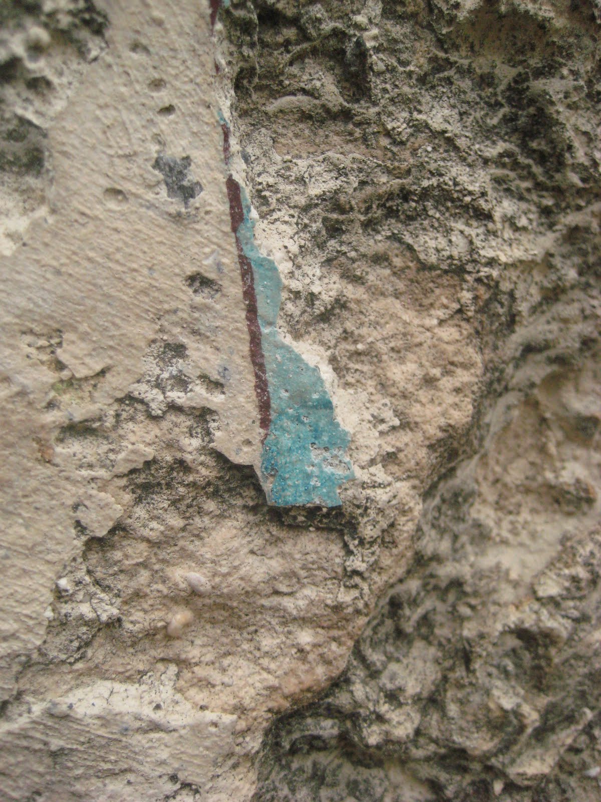
Many of the excavated objects at Mission San Luis were made there. However, it appears that because Mission San Luis was an important religious and political center during the 17th century, it was also a center for trade. Objects such as ceramics were imported from Mexico and Mission San Luis therefore became involved in a network of commerce, exchange, and interaction that extended into Mexico and the Caribbean. I just think that it's so cool to be here at Mission San Luis and look at all of these objects that were created by human beings, Apalachee and Spaniards alike, who lived here side-by-side, forming a unique community that was brought together because of religious and economic reasons. These objects are representative of those that were used by the 1500 people who lived here; basketweaving was an Apalachee tradition that antedated European contact.


Here is a picture of the Franciscan Church that was built at Mission San Luis (every single building is, of course, a reconstruction). I have also included pictures of the Apalachee Council House where religious, political, and social events took place. Before the ball game, for example, the Apalachee involved in the game would gather in the Council House and prepare for the game (just like they would do before going into battle; in fact, the ball game and its competitive elements replaced war when the Apalachee experienced times of peace). Over three centuries ago, the Apalachee Chief or "Holata" (pronounced O-lah-ta) lived in his own house adjacent to the Council House but Mission San Luis has not yet reconstructed the Holata's house. I also wanted to include a picture of one of the many bilingual signs at Mission San Luis in order to demonstrate that English and Spanish are used. Unfortunately, the Apalachee language became extinct by the end of the 18th century and there is scant information regarding Apalachee as a language. Sun is "Nico," Moon is "Hitoc," Water is "Oc," to see is "Picha," man is "Husti," and woman is "Tacaiali." These are not all of the Apalachee words that we know but I wanted to include a few of the words that I learned in my research.


Here are some pictures of the fort (the white building in the background) at Mission San Luis, the garden, and the friary. It is quite an interesting place for anyone fascinated by history, particularly "living history museums." I was happy to write the final paper in my Cultural Heritage class on Mission San Luis because I learned a lot about the history of Tallahassee, the people who once inhabited this territory, and the fusion of two cultures that lived side by side. Mission San Luis is thought to be an apartment complex by many residents of Tallahassee, which is a shame. For about fifty years, indigenous Apalachee and foreign Spaniards lived side-by-side here at the mission, creating a hybrid culture that is fascinating. Hopefully someday soon, the Apalachee people will be recognized by our government (which, of course, did not exist when the Apalachee lived in "la Florida"). Anyone who comes to Tallahassee should spend some time at Mission San Luis, if only to spend an afternoon learning about this historic site. It's a fascinating place!!


Saturday, October 22, 2011

Pacheco Murals in Merida

For my final day in Mexico I went to the palacio municipal de Merida in order to see twenty-seven murals by Fernando Castro Pacheco. Castro Pacheco was born in Merida in 1918 (and he's still alive, about to be 94 in January 2012). He is a painter, illustrator, engraver and printmaker who has had a distinguished career in Mexico and internationally. He created these "transportable" murals in the 1970s. They are called "transportable" because Castro Pacheco did not paint them directly onto the walls but rather onto large canvases that were then mounted onto the walls. They are stunning monuments that document certain events in Yucatan's (and Mexico's) history. As monuments, they claim the indigenous Maya perspective as their own. Some of these images are truly heartbreaking, as much of the indigenous histories of Mexico are not happy stories of freedom and liberty. However, there has always been much resistance in Yucatan to Spanish invasions and hegemonic control. A few of these murals demonstrate that spirit of resistance and desire for liberty. The first mural as one ascends the staircase shows how the indigenous peoples of Yucatan (and many more groups of Mexico) believe to be made from maize. It's a stunning mural that signals the combination of history and myth within the region. Anyways, I have many photos of all of these murals but do not have the time to post all of them and elaborate on their importance. But I hope that these pictures demonstrate to some degree the talent and creative vision of Castro Pacheco.


I love all of the colors that Castro Pacheco used in the creation of these images. The exploitation of Henequen started in preColumbian times but intensified after the conquest. The northern part of the Yucatan peninsula was particularly conducive for the cultivation of henequen (a plant that provides fibers for textiles, among other uses). During its zenith, the agroindustrial commerce of henequen during the 19th and early 20th centuries produced more than 200,000 tons a year. There were more than 200 plantations; currently, there are only remnants of this industry that was once flourishing. The cultivation of this plant brought large fortunes to a few, and the backbreaking work on these plantations was done by indigenous Maya groups. Castro Pacheco created two murals that underscore the indigenous hands and feet, bloodied by working daily with this "green gold."


I have to say that the 27 or so murals fascinated me and I spent almost 2 hours in the palacio municipal de Merida viewing these truly unique images. The one of Diego de Landa (who was Bishop of Yucatan from 1549-62) is particularly ominous, as his burning of several hundred (perhaps thousands) of indigenous books and idols was indeed an ominous precursor for what was to follow. Castro Pacheco, in my opinion, captures a much larger narrative with and through these images. To stand in front of them and learn about different aspects of Mexico's (and Yucatan's) history was an awakening experience. Our relationship with the external world is so immersed in images, and these murals form a narrative that, in silence, reflect the profound histories that structured Mexico's formation. The state of Yucatan, in many ways, has a distinct history from that of the diverse regions of Mexico. Castro Pacheco visually expresses, with singular events, the various discourses surrounding Yucatan's cultural history. I thoroughly enjoyed spending my last day in Mexico (for 2011) by viewing these magnificent murals.


Sunday, August 28, 2011

Coba


So here I am at the archaeological site of Coba. Coba is located in the northeast of the Yucatan peninsula, in the state of Quintana Roo, about an hour away from Valladolid (where the program was based). Coba is an enormous site! It surged into being the dominant city in its region, along with Chichen Itza, of the Yucatan peninsula during the Terminal Classic (from the late 9th century onwards). Coba was Uxmal's (another site located on the other side of the peninsula, about 137 miles from Coba) contemporary, counterpart site in the peninsula. During the Classic period (250-900 CE), Coba follows the general pattern of other Maya sites of this time period (they seemed to all have a close relationship with sites in the Peten region). At the end of the Classic, Coba asserted itself as the regional capital. Coba was a set of neighborhoods sprawled around a cluster of lakes. Coba has several clusters of civic-ceremonial architecture, and we were only able to see a few of these. I wanted to include a few pictures of Kati and Maggie because they were my Coba buddies. After our brief tour (given mostly in Maaya), Kati, Maggie and I rented bikes (for 35 pesos) in order to cruise around this enormous site (I have never had to ride a bike around an archaeological site before!!). It was a lot of fun and Kati had been here before so she gave us the little tour (including a stop at this stela that supposedly has some glyphs relating to 2012). Coba's area by the Terminal Classic covered 70 sq. kilometers (about 28 miles) with about 20,000 structures and a population around 55,000. Anyways, it was an incredibly hot and humid day, but I liked Coba and found it to be quite impressive.


I wanted to include a few pictures from around the site of Coba because it's such an enormous place! We were only able to see and experience a small fraction of the site because of time constraints. But I've included here pictures of a small tunnel that we traversed, one of the ballcourts, and a picture of one of the most picturesque buildings that I've ever seen at an archaeological site in Mexico. Despite the extreme heat and humidity, I did enjoy Coba (I usually do enjoy visiting these 'ancient' archaeological sites).


Here are a few pictures of me starting to climb the largest pyramid at Coba, called the Imoja temple. It is rather large (79ft), but it isn't the largest that I've ever climbed. Kati was nice enough to take a few of these pictures of me. The day was just so hot and humid! It made it extremely difficult to enjoy the site (and sights!).


We had to hurry (because of the small amount of time we were given to explore the site on our own) to get to the largest pyramid at Coba. It was an intense climb, but I always try to ascend these pyramids as quickly as I can. Going down is another story! I, of course, was completely drenched in my own sweat from the very beginning of the day as we left Casa Quetzal in Valladolid. As we stepped onto the archaeological site of Coba, all of us were already sweating profusely. Needless to say (or write), Yucatan is not my favorite place in Mexico because of its nasty humidity and heat combo. Anyways, as we got to the top, we looked at the tiny structure with a diving god in the center of it. The diving god still has some (supposedly) original paint on his legs. I then turned around and was able to see for miles in all directions. It was quite a sight.


The very last thing we did was go down into the cenotes right outside of the archaeological site of Coba. Here are pictures of Stephanie (with the kids) who was the program coordinator in Yucatan. It was potentially a treacherous descent into this particular cenote as you can see from the picture. The stairs were completely wet and extremely slippery, but luckily we all made it down safely. It was kind of eerie to descend into the earth's depths (it really wasn't too far down underground), and only a few people actually got into the water. I had to include a picture of Rosi, Tiana and me as we sat by the water's edge down in the cenote. It was an interesting way to end our day at Coba.